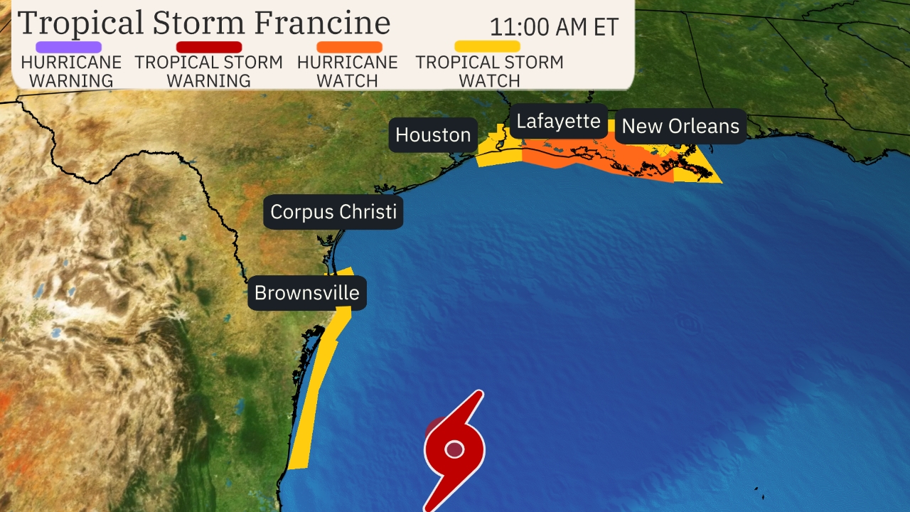
Tropical Storm Francine has formed in the western Gulf of Mexico and is forecast to become a hurricane threat to the Louisiana and upper Texas coasts by Wednesday.
The National Hurricane Center designated Tropical Storm Francine Monday morning, the sixth named storm of the 2024 Atlantic hurricane season, and first storm in almost three weeks.
Here’s the latest status of this system: Francine is centered over 400 miles south of Cameron, Louisiana, and is moving slowly north-northwest.
Most of the rain from this system is located offshore at this time, but some bands have reached parts of South Texas.
Some minor coastal flooding was recorded by tidal gauges along the Texas coast Monday morning from Port O’Connor south.
A hurricane watch has been issued from Cameron to Grand Isle, Louisiana. This watch is usually issued 48 hours ahead of when conditions deteriorate to make preparations dangerous.
A storm surge watch has also been issued from High Island, Texas, east of Galveston Bay, to the Mississippi-Alabama border, including Vermilion Bay, Lake Pontchartrain and Lake Maurepas. This means life-threatening storm surge is possible in these areas within 48 hours.
Tropical storm watches are in effect from northeast Mexico to Port Mansfield, Texas, and also from east of Galveston Bay to Cameron, Louisiana, and from near Grand Isle, Louisiana, to the Louisiana-Mississippi border, including Lake Pontchartrain. This means tropical storm force winds are possible.
Continue reading at the Weather Channel
For more on hurricane season and the utility industry, see how Duke Energy is strengthening the grid, ask yourself if you are making these heat related illness mistakes, and make sure you are stocked up on the must haves for storm season.


0 Comments