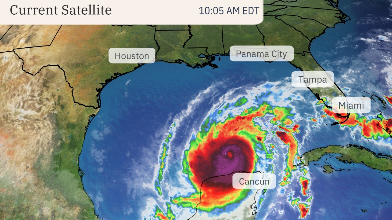
Hurricane Milton continues to pose a grave danger to Florida, where its potentially historic strike will bring destructive, life-threatening storm surge, widespread wind damage, flooding rainfall and tornadoes beginning Wednesday.
“Milton has the potential to be one of the most destructive hurricanes on record for west-central Florida,” the National Hurricane Center (NHC) said in its Tuesday morning discussion.
All preparations should be rushed to completion on Tuesday and if you’re in an area prone to storm surge, follow the advice of local officials and evacuate if ordered. This is a serious situation with the NHC forecasting a storm surge as much as 10 to 15 feet above ground level along the western Florida Gulf Coast, including the Tampa Bay area, if the peak surge arrives at high tide.
Here’s the latest status on Milton: The hurricane is centered 545 miles southwest of Tampa. It’s a strong Category 4 packing 145 mph winds as of 8 a.m. EDT and is tracking east-northeast at 12 mph.
Milton reached a maximum intensity of 180 mph on Monday, making it one of the most intense Atlantic Basin hurricanes on record.
An eyewall replacement cycle has caused Milton to undergo some decrease in intensity overnight, but it remains a serious threat to Florida.
Continue reading at the Weather Channel
For more on hurricane season and the utility industry, see how Duke Energy is strengthening the grid, ask yourself if you are making these heat related illness mistakes, and make sure you are stocked up on the must haves for storm season.


0 Comments