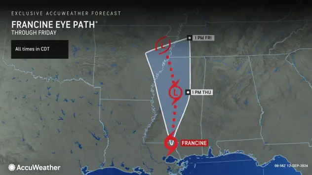
Flooding rainfall, damaging winds and tornadoes will continue as former Category 2 Hurricane Francine moves northward over the southern United States into Friday.
Hurricane Francine made landfall in southern Louisiana in the Parish of Terrebonne, about 30 miles south-southwest of Morgan City, as a Category 2 (Saffir-Simpson Hurricane Wind Scale) storm at 5:00 p.m. CDT. Maximum sustained winds were estimated to be near 100 mph along with dangerous storm surge and flooding rainfall.
Francine became a hurricane on Tuesday evening with maximum sustained winds of 75 mph. It quickly ramped up, becoming a Category 1 hurricane on Wednesday morning. After spending much of the day hovering near 90 mph on Wednesday, the hurricane strengthened a bit more to 100 mph just prior to landfall in Louisiana early Wednesday evening.
Peak wind gusts of Category 2 intensity (96-110 mph) were reported at several stories above the surface over the Gulf of Mexico on Wednesday afternoon, a sign the hurricane was gaining some strength.
The latest on Francine
As of 7 a.m. CDT on Thursday, Francine was located about 30 miles to the south of Jackson, Mississippi, and had lost more wind intensity after spending time as a tropical storm Wednesday night. Francine will transition from a tropical depression to a tropical rainstorm as it moves inland over the Southern states from Thursday to Friday.
Continue reading at AccuWeather
For more on hurricane season and the utility industry, see how Duke Energy is strengthening the grid, ask yourself if you are making these heat related illness mistakes, and make sure you are stocked up on the must haves for storm season.






0 Comments