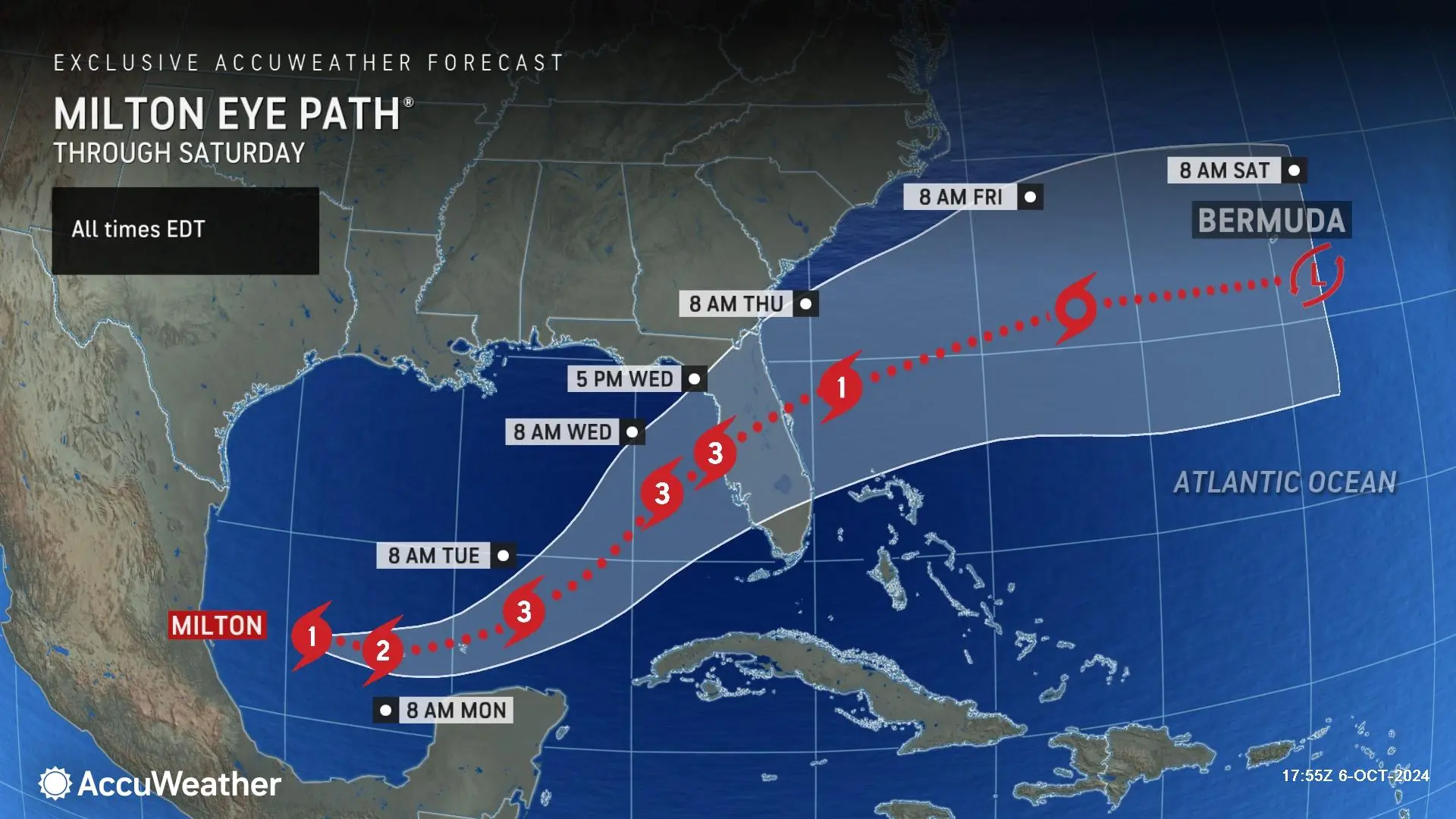
A state of emergency has been declared in Florida ahead of Milton, which is forecast to plow into the western peninsula on Wednesday as a major hurricane, packing wind gusts up to 140 mph and 15 feet of storm surge.
Just days after the devastating impacts of Hurricane Helene, another significant tropical threat to the U.S. is lurking in the Gulf of Mexico. AccuWeather hurricane experts are warning that Hurricane Milton will strengthen into a major hurricane and plow ashore in the west-central Florida peninsula later this week.
Impacts ranging from a devastating storm surge to major flooding from rain, damaging wind gusts, pounding surf and tornadoes are expected in Florida as Milton moves through during the middle of the week. Because of the risk, Florida Governor Ron DeSantis has declared a state of emergency and is urging that preparations to protect life and property should begin immediately.
“This is an unusual and extremely concerning forecast track for a hurricane approaching the Tampa Bay area,” warned AccuWeather Chief Meteorologist Jonathan Porter. “Milton could rapidly intensify into a major hurricane with extreme impacts. This hurricane could create a life-threatening storm surge. Please make sure your family and in friends in this area are prepared.”
Rapid intensification possible over the Gulf
Before Milton moves ashore in Florida, it will have ample time to rapidly strengthen over the very warm waters of the Gulf of Mexico. That has already been seen this weekend, as the storm went from a tropical rainstorm to a depression to a named storm in just a matter of hours on Saturday, and then a hurricane on Sunday afternoon.
“The ocean heat content is at the highest level on record for this time of year in the Gulf, despite the recent passage of Helene,” added AccuWeather Lead Hurricane Forecaster Alex DaSilva. “The deep, warm waters can act like rocket fuel for Milton, allowing for rapid intensification.”


0 Comments